Costs
Why a Tow Costs More Out Toward the Kern River Canyon Near Bakersfield
A tow from the Kern River Canyon costs more than one inside Bakersfield mainly because of the miles. Highway 178 leaves the city's northeast side and climbs a narrow, two-lane canyon. Some river spots sit about 20 miles out. The truck drives all the way up to you, then hauls your car back down. Where the car sits and what broke matter too. You see your price by text before anyone heads your way.
Why does the canyon change the price so much?
In town, SR 178 is a short freeway. It runs from near downtown out to the northeast side. Shops are close by. A dead car on that stretch is a quick trip.
Past the edge of town, the road becomes something else. The U.S. Forest Service says the two-lane road "winds up the steep, narrow canyon," with the river far below. Caltrans calls the area rural, running through the Kern River Canyon to Lake Isabella.
The Forest Service puts Lower Richbar Picnic Site about 20 miles northeast of Bakersfield on Highway 178. A car that dies near there is a long way from a Bakersfield shop. Your driver covers those miles twice: once to reach you, and once to bring your car back.
California law puts that on paper. If you're with your car, Vehicle Code 22513 says the tow company must give you a written, itemized estimate before hookup. It has to show mileage "from dispatch to return." Out in the canyon, that line carries most of the price.
What else moves the number on Highway 178?
Miles come first. These come next:
- How far up the canyon you are. A stall near the mouth of the canyon is a shorter run than one up near Delonegha, where the highway crosses the river.
- Where the car is going. Back to Bakersfield, or up toward Lake Isabella. Each makes a different haul.
- Where the car is parked. A paved spot next to the road is a simple load. A car down a dirt road to the river is a different job.
- What went wrong. A dead battery or a flat may not need a tow at all.
- Whether the road is open. If Caltrans closes the canyon, no truck gets through until it opens.
Is a breakdown on a river dirt road harder to tow?
Often, yes. The Forest Service says several developed day-use areas sit along Highway 178, with picnic tables, restrooms and fishing access. It also says dirt roads lead to popular river spots, such as Black Gulch.
That's where many canyon calls start. You park on soft dirt for a day by the water. When it's time to leave, the tires spin. Or the car won't start after a long day in the sun.
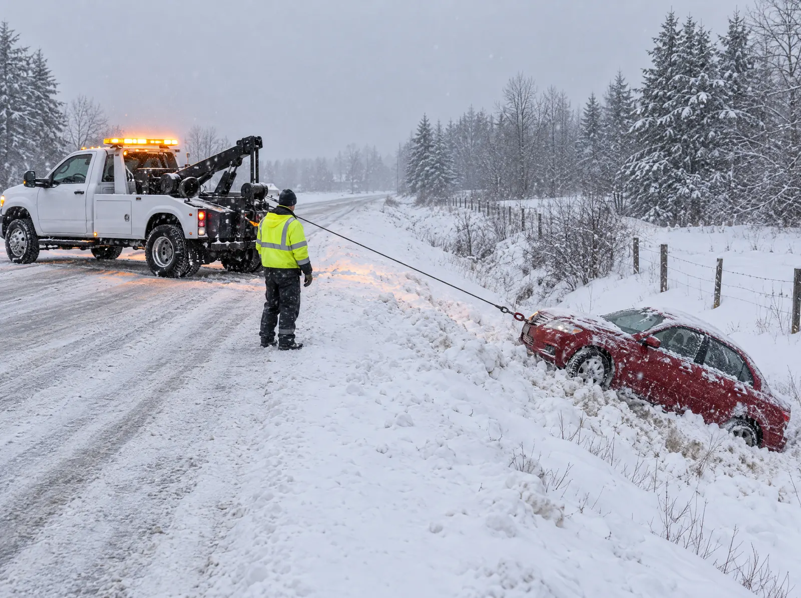
A car stuck in loose dirt or sand may need a winch-out first. Your driver pulls it back onto firm ground. If nothing is broken, you may drive home from there. That's often a smaller job than a full tow back to town.
Tell the dispatcher exactly where the car sits. Is it on pavement or dirt? How far from the highway? Is it nose down a slope? Those details help your partner tow company bring the right truck and set a fair price the first time.
Stay out of the river while you wait
The water looks calm in spots. The Forest Service warns that drowning is the top cause of accidental death along the Kern. Strong currents, cold water and hidden rocks can trap strong swimmers. Keep kids and pets well back from the bank while you wait.
Can a lighter job replace the tow?
A lot of canyon trouble is small trouble. Match the job to what really happened, and you skip the long haul.
| What happened up the canyon | Ask about this first |
|---|---|
| Car won't start after a long day at a picnic site | A jump start |
| Tires sank into soft dirt near the river | A winch-out to firm ground |
| Flat tire on the drive in, and your spare is good | A spare tire change |
| Gas light came on, and you're still far from a station | Fuel delivery |
| Engine overheated, leaking or making grinding sounds | A car tow to a shop |
Heat plays a part here. NOAA's 1991 to 2020 normals show about 100 days a year of 90°F or hotter at Bakersfield's airport. A long climb on a hot afternoon is hard on a tired cooling system. If your gauge creeps toward red, pull off where you can, shut the engine off and let it cool. Steam or a sweet smell means it needs a shop.
Should my car go back to Bakersfield or up to Lake Isabella?
Think about where you'll be while the car gets fixed. That answer often decides the haul.
- You live in Bakersfield. A tow back down the canyon gets you to your own mechanic. It's a longer trip, but you won't need a second tow later.
- You're staying up the hill. If you have a cabin or a campsite near the lake, a shop up that way may make more sense. Ask if your partner can do that run.
- You're just passing through. Pick the town you'd rather wait in.
Ask for both options when you call. A shorter haul usually lowers the price. Your price is locked before dispatch, so you can compare and choose.
What happens if Caltrans closes Highway 178?
The canyon road does close. In May 2023, Caltrans District 6 made an emergency closure of SR 178 for cracks in the roadway near the water at the mouth of the canyon. In February 2024, it closed the road through the Kern River Canyon for multiple rockslides and debris. Caltrans said there was no estimated time to reopen.
A closure changes the job. A tow truck can't drive past a closed road to reach you. If you're on the far side, help may have to come from the other direction, or the job waits. Some drivers know Old Kern Canyon Road, County Road 214. The Forest Service says it splits off Highway 178 at Democrat and climbs along the southeast side of the river. Don't count on any side road being open during a closure. Follow what Caltrans and the CHP tell you.
Before you head out from Bakersfield, check Caltrans QuickMap or the Caltrans road info page for SR 178. You can also call 1-800-427-7623.
What should I do while I wait in the canyon?
- Get as far off the two-lane road as you safely can. Don't stop on a blind curve if the car still rolls.
- Turn on your hazard lights. Under Vehicle Code 21809, passing drivers must move over a lane when they safely can, or slow down.
- Bring water. The Forest Service says there's no drinking water at Lower Richbar.
- Note the last day-use area or landmark you passed, such as Delonegha or the turnoff at Democrat.
- If your call won't go through, write down where you are. Then try again from higher, open ground nearby, staying well clear of the road.
If anyone is hurt, or your car is stuck in a live lane, call 911 first.
How does Sentinel price a canyon job?
Sentinel Towing is a towing and roadside network, not a tow company. A vetted local partner tow company does the work. You tell us where you are on Highway 178 and where the car should go. If a partner can reach you that far out, we text your price before dispatch, and it's the most you pay for the job. If the job changes, you get a new price by text first, and you decide. Then we check on you by text until the truck arrives. That's our Stay-With-You Promise, and you can track your truck on a map.
For help anywhere from Oildale to the SR 58 grade, see our Bakersfield towing page.
Stuck right now? Call 1-888-TOW-1213, or request help online.
Kern River Canyon Tow Cost Questions
Why is a tow from the Kern River Canyon more than a tow in town?
Mostly distance. Some river spots on Highway 178 sit about 20 miles from Bakersfield. Your driver covers those miles out and back. California estimates must list mileage from dispatch to return.
My car is stuck in the dirt by the river. Do I need a tow?
Maybe not. If the car isn't damaged, a winch-out can pull it back onto firm ground. Then you may drive home. Tell the dispatcher how far the car is from the highway.
Can a tow truck reach me if Highway 178 is closed?
Not through the closure. Caltrans has closed the canyon road for rockslides and river damage before. Check QuickMap, stay put if it's safe, and call once the road is open.
Will I know the price before the truck comes up the canyon?
Yes. We text your price before dispatch. That price is the most you pay for the job, unless you agree to a new price first.
Rules change, so check the official source before you rely on it. Sources: Sequoia National Forest: Lower Kern River, Sequoia National Forest: Lower Richbar Picnic Site, Caltrans Kern Canyon Culvert Rehabilitation study, Caltrans District 6, February 2024, Caltrans District 6, May 2023, Caltrans road info: SR 178, Caltrans QuickMap, NOAA climate normals, California Vehicle Code 22513, California Vehicle Code 21809.